


3 AM CALL TIME FOR THE DMZ TOUR? CHECK!
On our last day in South Korea, my friend Hannah and I opted to go our own merry way from Seoul to join a DMZ tour. Actually, it’s more like me saying ‘I really wanted to go to DMZ, are you up for it?’
Had she said no, I’d probably still go even though it was closed for tourists the week before because of uhmm North Korea’s ballistic missile launch. It was then confirmed by our tour guide that day.
About the Korea DMZ
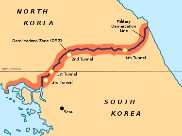
The Korean Demilitarized Zone is a strip of land running across the Korean Peninsula near the 38th parallel north. The demilitarized zone is a border barrier that divides the peninsula roughly in half.
It was established to serve as a buffer zone between the countries of North Korea and South Korea under the provisions of the Korean Armistice Agreement in 1953, an agreement between North Korea, China, and the United Nations Command.
DMZ is situated at the border of South Korea 160km along the Pyongyang-Kaesong Motorway southeast of Pyongyang.
Source: Wikipedia
More about the DMZ (from the leaflet I got at Imjingak Park)
On July 27, 1953, the Korean War ended with a cease-fire. The Northern and Southern Limit Lines were created as each side moved their troops back 2 km from the Military Demarcation Line. The lines reach 248 km in length from Jeongdong-ri, Paju-si, to Myeongho-ri, Goseong-gun.
At present, an area within 2 km on both the north and south side is designated as the DMZ. Excluding the DMZ, the overall area is considered the most heavily militarized region in the world.
DMZ was not part of our DIY plan as a group, not even part of our original tour (read here why our original tour schedule was canceled). At the back of my head though, I knew I wanted to go. I’ve read about it years before and got curious about the history behind it. I told myself that when I’d get the chance to go to South Korea, DMZ is going to be part of it.
I booked our DMZ tour via Klook 2 nights prior. Below is the exact tour I booked.
Klook.comThese were the highlights of the tour:
- Learn more about the history of the Korean War and the Cold War on this educational guided DMZ tour
- Places such as Imjingak Park, the Freedom Bridge, the Third Infiltration Tunnel, Dora Observatory, and the DMZ Exhibition Hall will be visited
- Have a bird’s eye view of North Korea through the binoculars located on top of the observatory towers
I’ve read beforehand that despite the DMZ being considered to be an extremely dangerous place and one of the most heavily-armed borders in the world, it is still one of the most heavily-visited tourist destinations in South Korea.
According to this blog, many of the landmines installed during the 1950s are still active, and every few years, there is an incident of a soldier or civilian setting one off or coming into contact with an unexploded mine.
It made me a bit anxious, but reading the reviews from Klook made me decide to go on. Besides, I’ll never know when my next Korea visit will be (hopefully soon again though) so yeah, let’s do this now!
According to the Klook activity page, ideally, the tour starts at around 8 AM but I’ve read from the reviews that because so many tourists visit the place, the tour guides have to line up super early to get tickets to ensure that we can all go in by 8 AM and finish the tour just after lunch. They left a Whatsapp number which was a relief because the confirmation took a while.
The night before the tour, I got a Whatsapp message saying that we’d need to leave by 3 AM, explaining exactly what I’d already read from the reviews. Thankfully, hotel pick-up was part of the tour so we didn’t have to look for a ride in the wee hour of the morning.
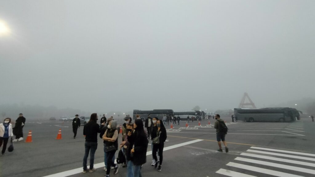
Our private car arrived, we picked up another group of tourists from a nearby hotel, then we were brought to the side of the street where a big bus was waiting. I didn’t even know where we were because it was still dark. The bus was already full when we arrived – it turned out we were the last to be picked up.
We began the journey to the DMZ. I was still so sleepy so I didn’t manage to check my phone anymore to check where we were heading. But I remember it was sooo dark and foggy on the way there and I was feeling a bit disoriented because I couldn’t see anything when I looked out the bus window. I think it took about 2 hours to reach the place.
When I woke up and looked out the window, we’d arrived. The tour guide kept reiterating where WE ARE NOT ALLOWED to take photos and videos. We were not allowed to take photos of the military checkpoints and the military personnel or ask to take a photo with them.
I put my phone inside my bag to make sure I wouldn’t involuntarily open it. Obviously, no one wanted to get arrested. 😰 The military personnel checked everyone’s passports. Each one has to point their name listed on a sheet of paper and show their passport. The military checked to see if it’s matching and moved on to the next person. This happened once before entering and once before leaving the premises.
Did you know?
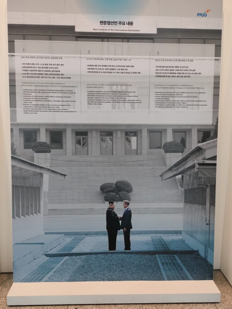
The two Koreas are technically still at war, engaged in a frozen conflict. However, in April 2018, the leaders of North and South Korea met at the DMZ and agreed to work toward a treaty to end the Korean War formally.
After April 2018 with the participation of North Korea in the Winter Olympics, the two Koreas have seen a major diplomatic breakthrough and become significantly warmer. They signed the Panmunjom Declaration for Peace, Prosperity, and Unification of the Korean Peninsula.
Read more here.
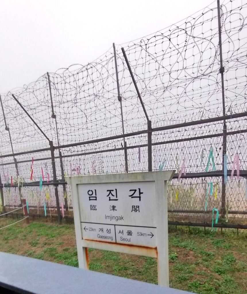
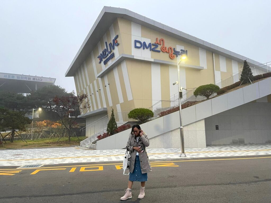
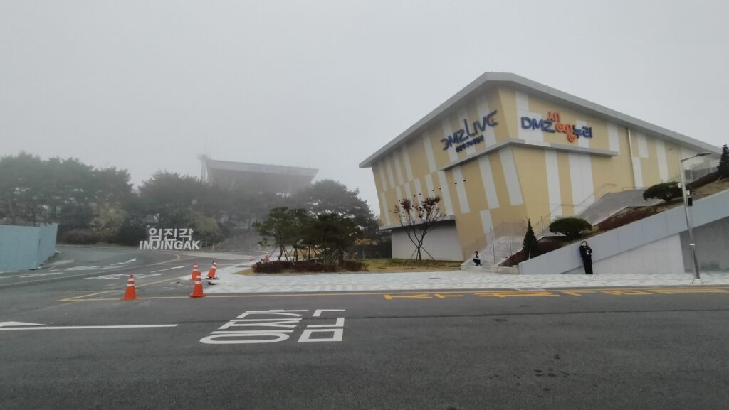
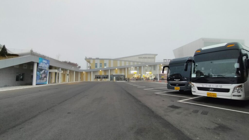
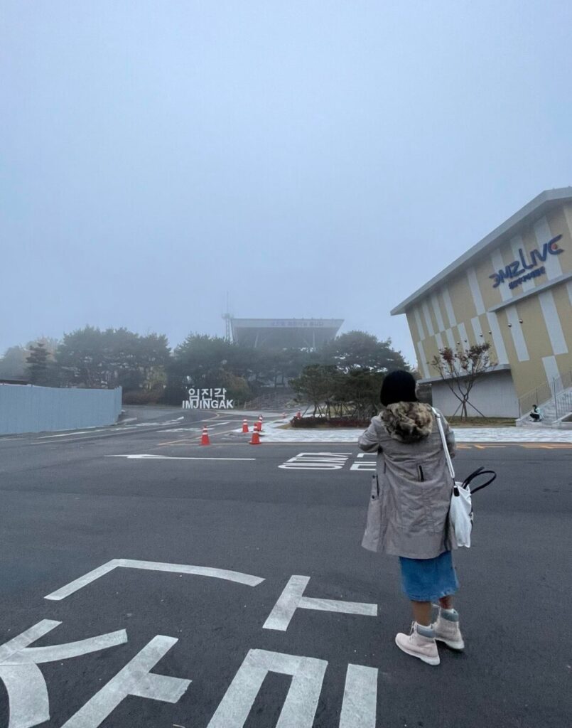
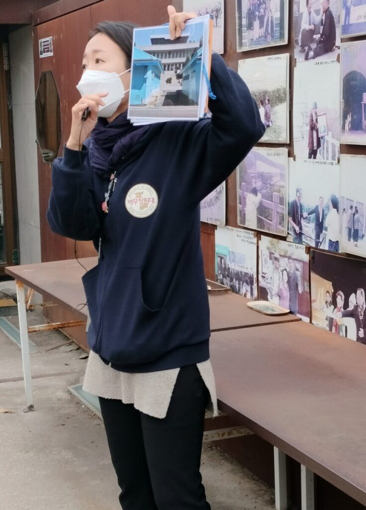
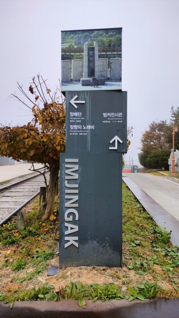
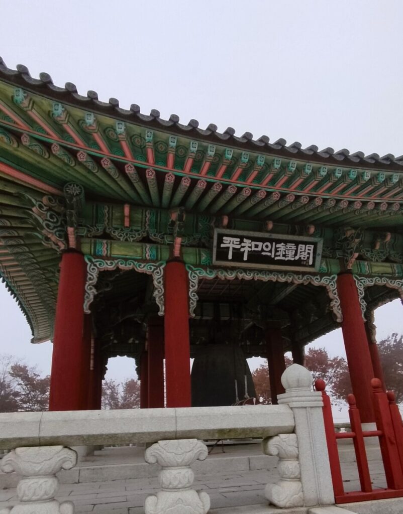
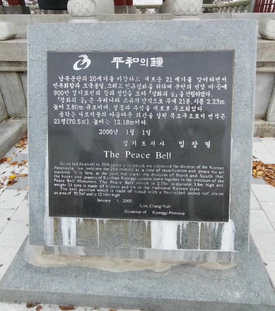
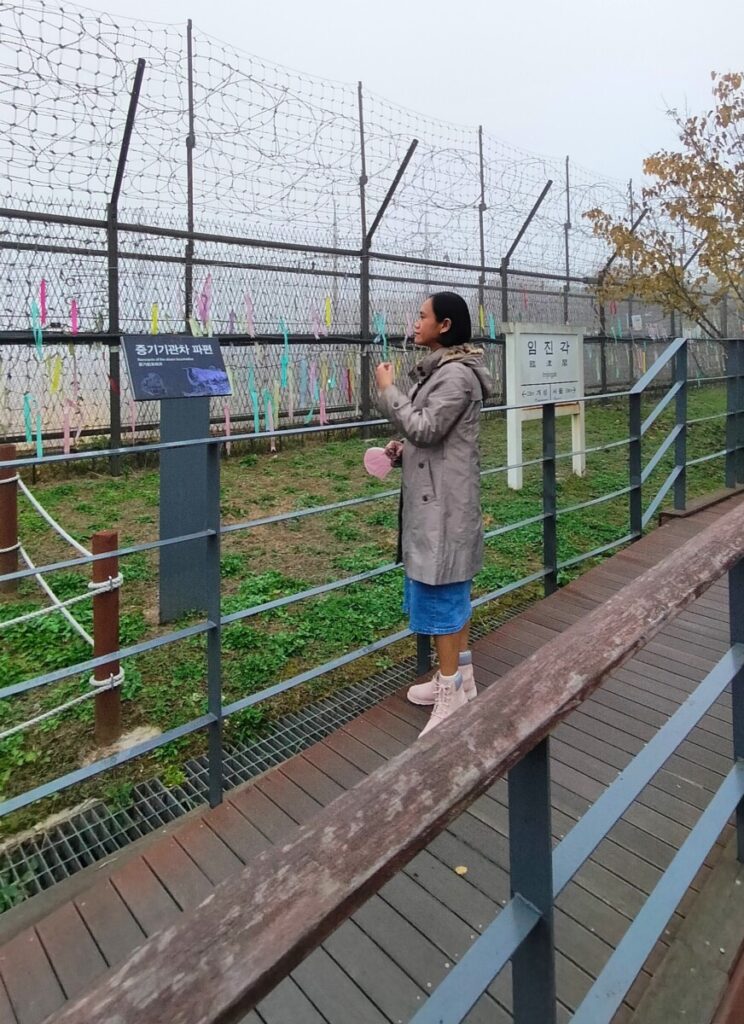
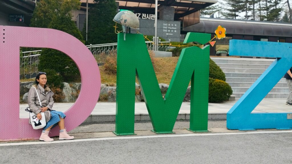
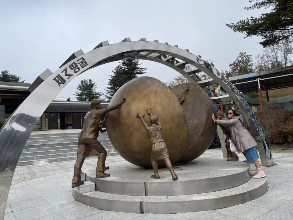
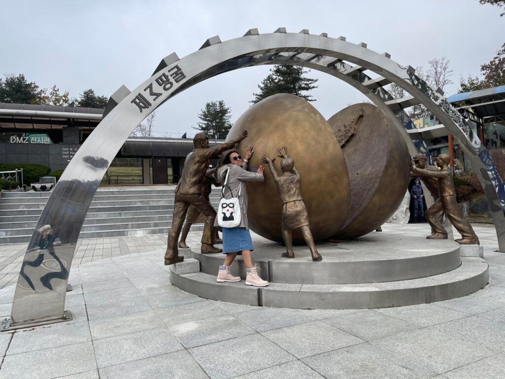
First Stop: Imjingak Park
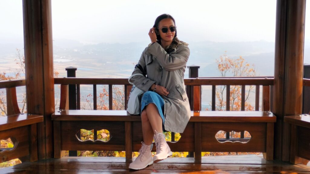
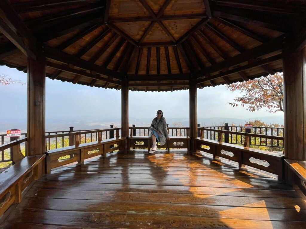
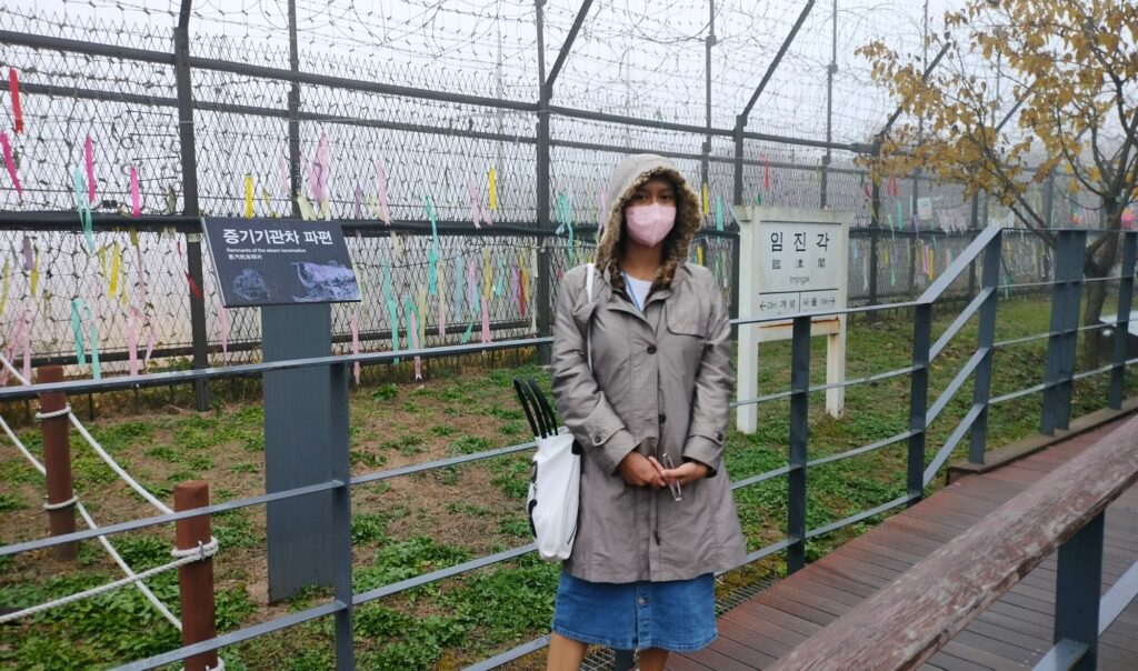
Imjingak Park is located within the demilitarized zone (DMZ) of North Korea and South Korea. This was where our Korean tour guide got our tickets for the entire tour. When we arrived, IT WAS SO COLD. Colder than Seoul. I didn’t check the temperature but it was cold for my tropical skin, lol. 💧 See the foggy photos below.
Side note: that morning, I wasn’t thinking of wearing a coat because I thought it was probably not as cold as Seoul. Good thing I still wore mine ‘just in case’ I’d feel cold. What was I thinking?! If I didn’t wear it, I would have frozen. Haha.
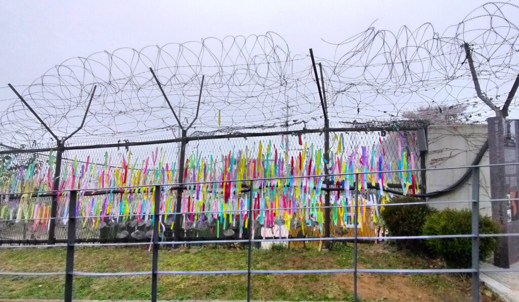
The park is said to be dedicated to the 10 million South Koreans who were separated from their families when the peninsula was divided. Located 7 km from the Military Demarcation Line, it is now at the forefront of tourism related to the Korean Conflict.
We went through some famous landmarks and our tour guide explained each one in English. It was like an interactive field trip – which I loved!
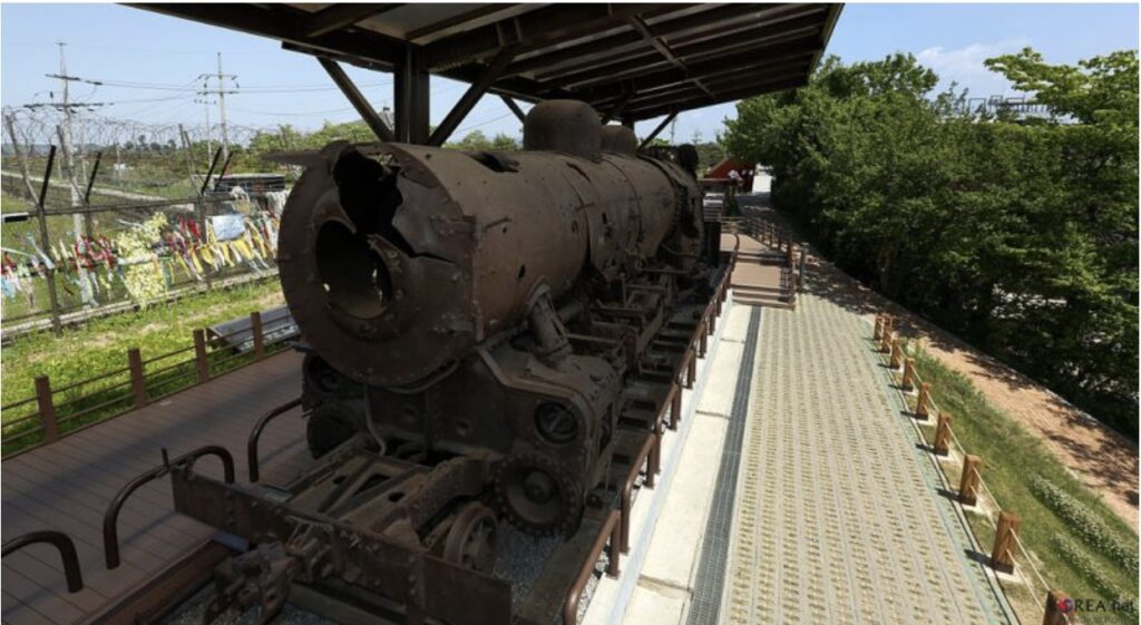
Just in front of me was the steam-powered, coal-fired train (I didn’t have a photo because it was covered at that time) preserved at the Imjingak pavilion. It is said to be a symbolic element of the Korean War. Covering its body are several bullet holes that serve as evidence of the war years ago.
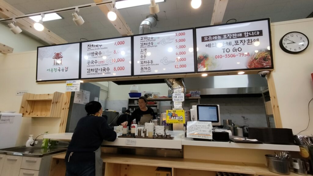
After going around, we bought some souvenirs and then headed back to our bus. The entire place was pretty convenient. There were lots of stores and restaurants within the vicinity if you ever feel hungry.
There was also a gondola called Peace Gondola which I would have wanted to experience but we couldn’t make it to their schedule because of the limited time we had.
The Imjingak Peace Gondola is the world’s only gondola that travels the Civilian Control Zone (CCZ) area. Through the 1.7 km-long gondola, passengers can easily visit the CCZ or between the north and the south beyond the Imjingang River and appreciate the DMZ area with speed and comfort.
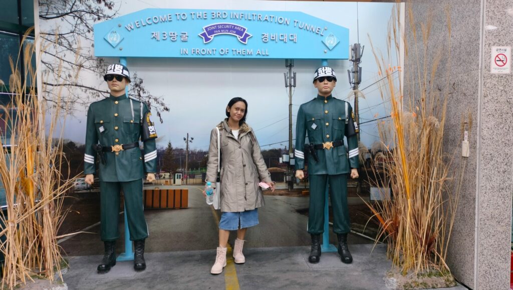
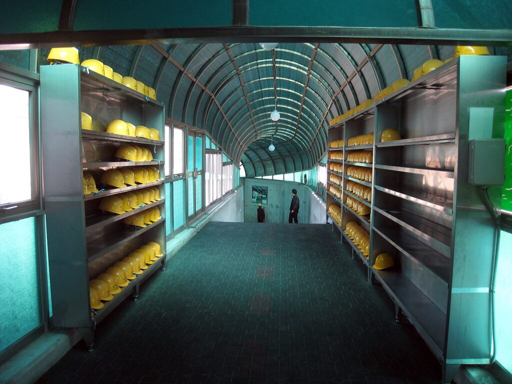
Second Stop: DMZ Tour Station & Third Tunnel
After Imjingak, we headed to the DMZ station where we had a quick tour of the DMZ exhibit hall. After taking a few photos, we headed directly to the Third Infiltration Tunnel just across the hall.
Taking photos in the tunnel was not allowed so we had to leave our phones (and our belongings) inside one of the lockers in their lobby. The locker was free. Get the key, bring your water, then head to the tunnel.
About the Third Tunnel
The Third Tunnel of Aggression (Korean: 제3땅굴) or Third Infiltration Tunnel is one of four known tunnels under the border between North Korea and South Korea, extending south of Panmunjom.
The South Koreans have blocked the actual Military Demarcation Line in the tunnel with three concrete barricades. Tourists can walk as far as the third barricade, and the second barricade is visible through a small window in the third.
We were advised to bring a bottle of water because it was a long walk inside the underground tunnel. We were also told that we didn’t have to finish the entire walk or that we didn’t even have to go if we didn’t want to.
The tunnel was not for the faint of heart and the claustrophobics (which are probably me, tbh haha) but it was all good. I felt great that time and I really wanted to see what was inside.
According to our tour guide, the North first denied that it was an infiltration tunnel. They said it was just used for coal mining, however, the South found out that there were no signs of coal in the area so they concluded that it was indeed designed to secretly attack the South.
It is estimated that approximately 30,000 soldiers could move through the tunnel per hour and was thought to be more threatening as an invasion tool than the 1st and 2nd Tunnels.
It wasn’t your usual hot, dusty, and dark tunnel so you don’t have to worry. It was already made up for tourists. There were lights inside and it was air-conditioned. There was a bench and an oxygen tank/mask every few kilometers, and there was a railing you could hold on to while walking. I also saw emergency responders outside the tunnel ready to assist in case someone needed help, plus there were also CCTV cameras all over.
You have to wear a construction helmet and truly it’s for good measure. I bumped my head a couple of times. There were also slippery parts so we really had to be careful. We made it to the end of the tunnel that was open to tourists. The rest of the tunnel was blocked.
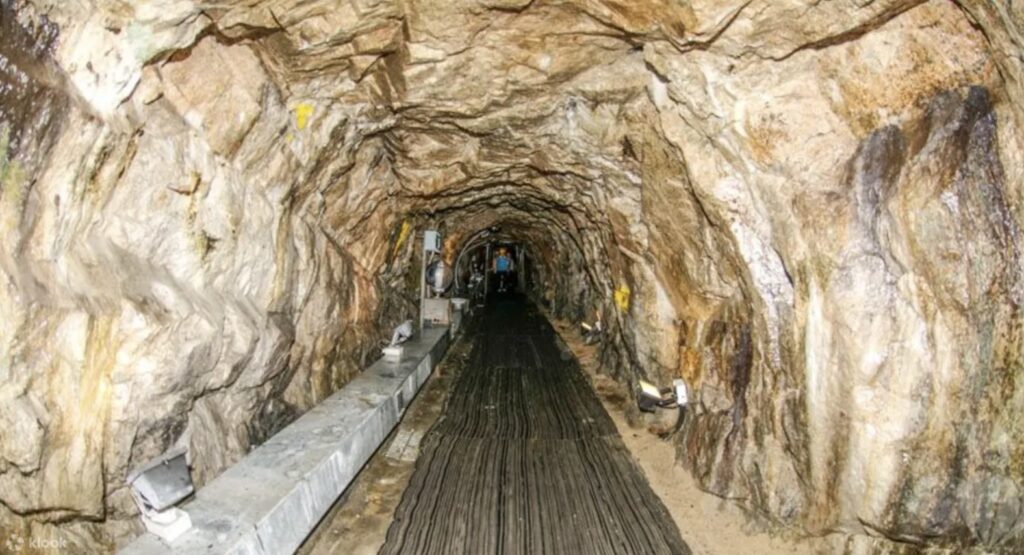
^ That’s an official tour photo from Klook. It might have been an old photo because when we were in the tunnel, there were railings on each side to help the tourists along the way and the ground was not quite like that. It was cleaner and more polished, so I’d say there had definitely been improvements made to make it safer and easier for tourists.
The total length is 1,635 meters (1.01 miles) with a width and height of 2 meters (6.56 feet). It lies about 73 meters (239.5 feet) below ground. From the demarcation line, it runs 1,200 meters (3,937 feet) into the north and 435 meters (1,427 feet) into the south.
A concrete blockade is as far as visitors inside can walk. It lies only 170 meters (557.7 feet) from the demarcation line, which prevents access from the north.
Source: The Seoul Guide
Getting inside is a downhill walk so it was a bit easier, albeit trickier because if you’re not careful, you might find yourself rolling to the end. 😅 Even though you can go at your own pace, somehow you’ll feel like the people walking behind you put pressure on you to walk faster. Don’t be pressured, lol. It isn’t a race, so yes, you can still keep walking at your own pace.
Getting out of the tunnel is another story because it’s an uphill walk. You’ll need to have more energy and willpower. Upon going back, we also saw a monorail or motorized trolley that could transport people in and out. I think it was down when we went because no one was able to use it. Walking was more fun though and we burned some calories there so it’s a win-win.
I didn’t know how long it took us to complete the entire walk but my legs hurt after, so yeah, that’s probably one heck of a walk. Finally, we reached the lobby, got our bags from the locker, went to buy some stuff at the souvenir shop, took some photos, and off we headed to the Dora Observatory where we would see a glimpse of North Korea.
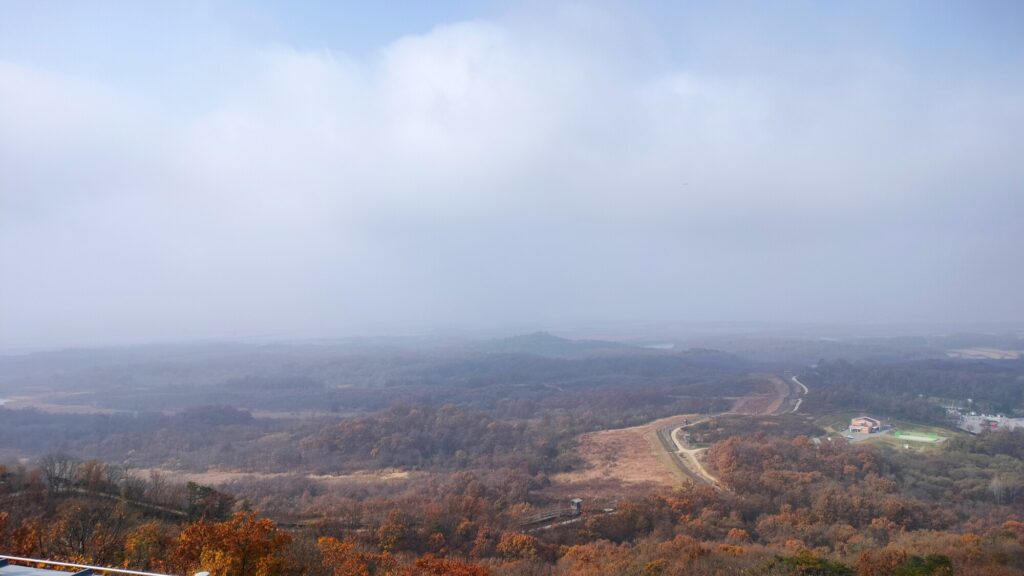
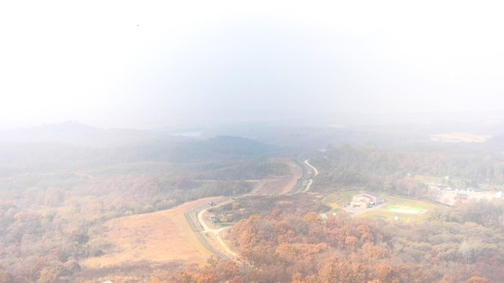
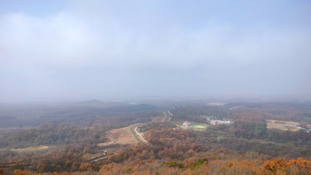
Third Stop: Dora Observatory
This was our last stop. Dora Observatory is said to be the closest you can be to the North so I was excited to be there. The only thing regrettable about the entire tour was the FOGGY FOG FOG. I just tried my best to see through the binoculars and imagined which part I saw from the video they played before we went to the observatory.
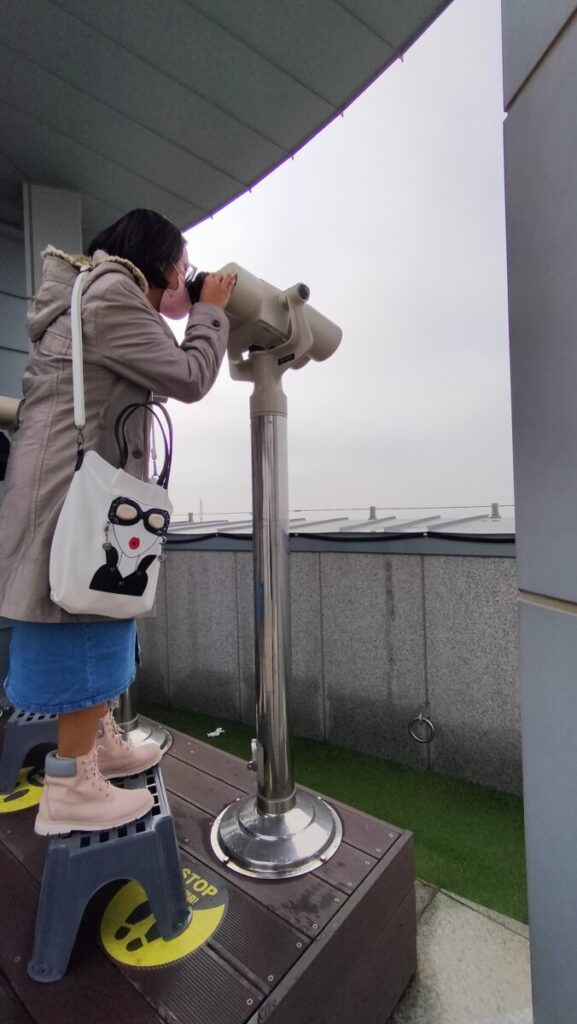
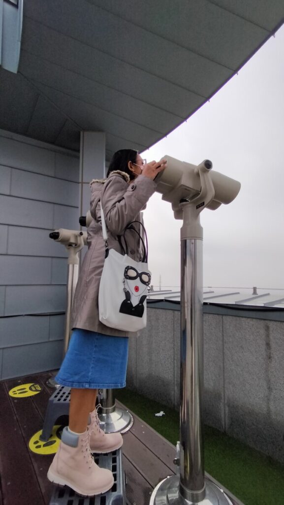
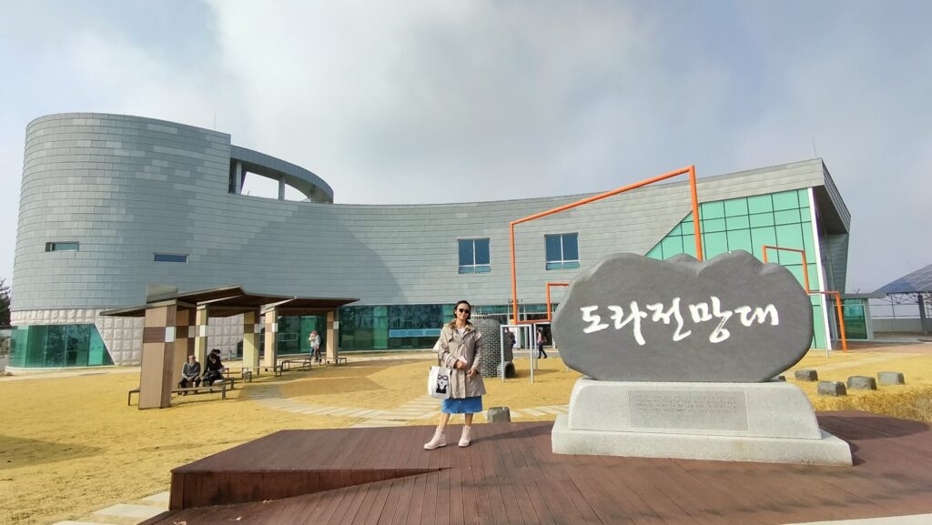
Dora Observatory is on the South Korean side of the 38th parallel. Situated on top of Dorasan (Mount Dora) in Paju, the observatory provides scenic views across the Demilitarized Zone.
Visitors can see the North Korean territory through binoculars from the 304 square feet, 500-person capacity observatory. They are able to see the North Korean propaganda village situated in the DMZ and can also see the city of Kaesong.
It was good enough but it could have been better if it was a clear sunny day. Nonetheless, it was an unforgettable experience and it was so surreal for me to be there.
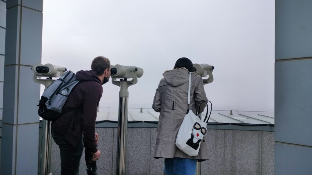
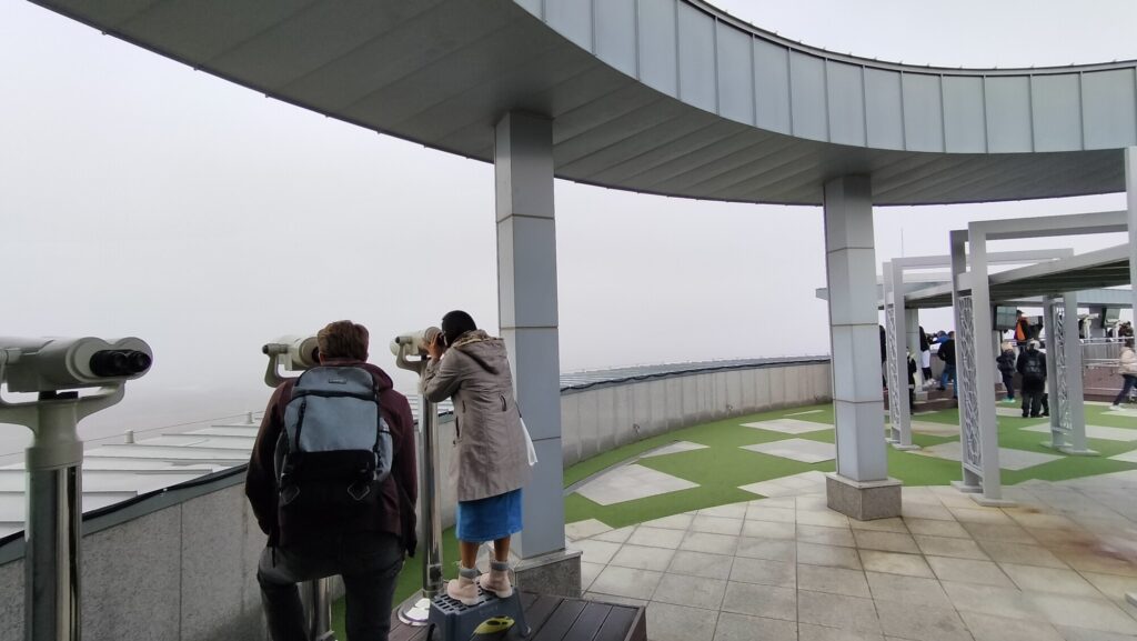
Looking at the photos above, it does look like we were looking at nothingness. Zero visibility. Nada. But after a few minutes of waiting, it cleared up a bit. See photos below.
But of course, you cannot see what I saw from the binoculars. 🔭 At least maybe this will encourage you to visit DMZ and see this for yourself in the future.😅

Now, you might be looking for the well-known Joint Security Area or JSA.
When I checked previously, there was a tour to the JSA in Klook but it looks like it was temporarily stopped during the pandemic. Our tour guide did mention that it was closed at that time and wasn’t sure when it will reopen but I have read somewhere that it will reopen this 2023!
I also really, really wanted to join a JSA tour or at least wanted it to be part of the itinerary. It was what I’ve always imagined when thinking about going to the DMZ or South Korean border. It’s the highlight of the show.
The JSA is even closer to the North as you can see in the photos below. Our tour guide even mentioned that it’s risky and you cannot enter on a DIY tour so it’s best to be on an organized tour. She also said that if we make a mistake or break some rules (like accidentally tripping over to the North), unfortunately, they cannot do anything about it a.k.a. they most probably cannot save us. 😨
The Joint Security Area (JSA, often referred to as the Truce Village or Panmunjom) is the only portion of the Korean Demilitarized Zone where North and South Korean forces stand face-to-face.
The JSA is used by the two Koreas for diplomatic engagements and, until March 1991, was also the site of military negotiations between North Korea and the United Nations Command (UNC).
Source: Wikipedia
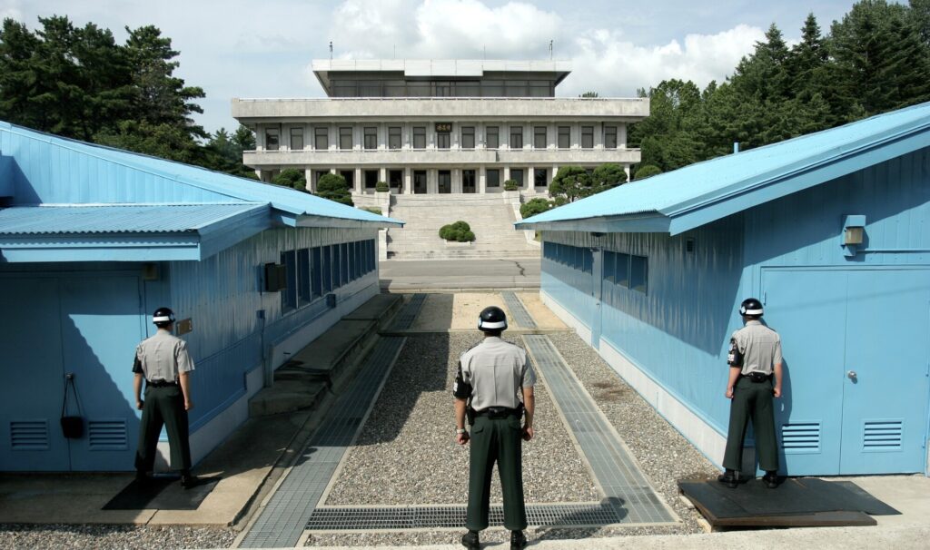
^ View from the South. Photo from Wikipedia. Those are South Korean soldiers standing guard at the JSA.
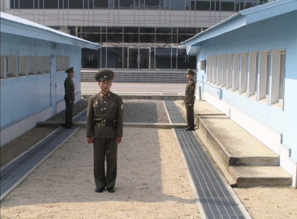
^ View from the North. Photo from Wikipedia. To the rear is the ground floor of Freedom House in South Korea. The brick ledge is the actual physical border mark in the security area.
Those photos are some of the most iconic photos of Korea as most of the negotiations happen in this area.
That’s it! This is lengthy. Haha! But that’s the summary of my DMZ experience that I will never forget. Will I go for round 2 next time? When given the chance, absolutely!